I convinced six other mid-week slackers to go on a trip with me last Tuesday, up to some slightly obscure but spectacular peaks on the Coquihalla. As it normal with mid-week adventures, when there are no fixed dates like the weekend, everything happens last-minute. In this case it would be at a potluck the night before. I made sure to print out the directions for the road this time, and brought along a GPS just in case, hoping to avoid the logging disaster on the Old Settler back in August.
The access to Vicuna and Guanaco Peak is via the Upper Coldwater River FSR, which is on the other side of the old toll booth. Directions to get here are well described by the latest 103 Hikes Book. It takes about two and half hours driving on the highway, and then another half an hour or more to drive the final 14 kilometres on a mostly good gravel road, with some slide alder obstruction.
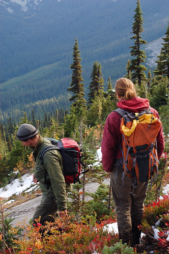
When we finally left the parking spot at 11am, Meghan was skeptical of climbing both Vicuna and Guanaco peak due to the limited daylight. As it turns out, the trail up to the alpine is very quick on a steep trail. I think we could have reached the Vicuna-Guanaco col in an hour and a half, but there were too many blueberries stopping our momentum.
Hiking up towards the base of Vicuna’s expansive slabs
Group shot (minus Meghan) at the base of the east face of Vicuna Peak. Lots of unclimbed slabs here.
Anne walking up next to the slabs on Vicuna.
There were so many blueberries here, unreal considering it was already October.
The spectacular Anderson River range. There’s some great alpine rock climbing here. Access is from the other direction.
Granite, snow and trees.
I was hoping for less snow out on the Coquihalla, but that wasn’t quite the case today. The northeast ridge of Vicuna Peak was plastered in snow. It was a bit tricky going through the Class 3-4 section on the exposed ridge, but with the help of a fixed line there we made it to the summit. Spectacular panoramic views of all the mountains here.
Only Meghan, Christian, and I continued to the summit. The rest of the group deemed it too sketchy, and continued onward towards Guanaco Peak instead. After carefully downclimbing the ridge, we meet up with the other group at the summit of Guanaco Peak. The ramble up to Guanaco peak is fairly straightforward, except their was a mountain troll who kept throwing snowballs at us. The two peaks are all about the same elevation, with Guanaco Peak being 1m higher.
Summit shot. Natalie, Meghan, the Mountain troll, Oliver, Anne, Champange, me.
Spectacular views of Bighorn Peak.
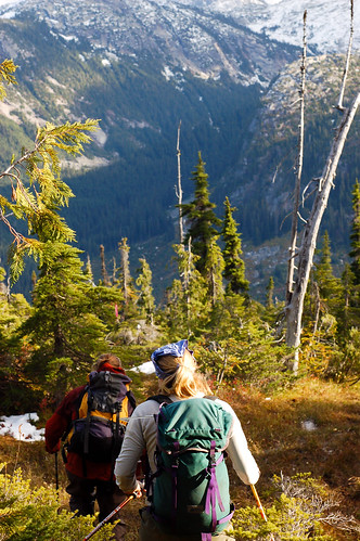
Descending down from Guanaco Peak towards the col
Vicuna Peak, a dramatic granite horn in the Anderson River range
Oliver and Nat on their way down the meadows
Anne and Meghan on their way down the meadows
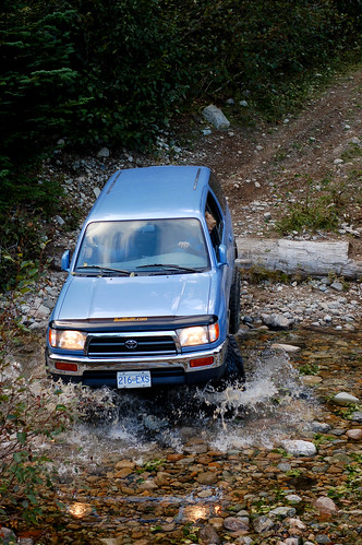
Colin decided to drive his truck further up the road past the normal parking spot. He almost cleared this log on the way back, but ended up putting a small dent on his license plate attached to the armoured rear bumper. Colin has done some work on his truck so I think he was particularly keen to test out his truck. He didn’t go all the way though, stopped about 3/4 of the way to the trailhead at the deeper creek crossing.
What a fantastic day. A highly recommended daytrip. The scrambling on Vicuna is probably best when there isn’t snow on it though. It is a long drive up to the Coquihalla, so you could combine a trip here with scramble up to the other peaks on the Coquihalla.
More photos


Great blog Rich! Looks like you are having lots of fun adventures. Amazing photos.
Thanks alot Dave! Appreciate it. Your island adventures are quite interesting too!